[ad_1]
In Arnhem Land, Northern Australia, where an estimated 22,000 buffalo roam freely, scientists are embarking on a mission to track and manage the animals from space.
The project, aptly named SpaceCows, is a groundbreaking initiative that combines satellite technology, artificial intelligence (AI), and indigenous knowledge to address the ecological and economic threats posed by feral buffalo and cattle.
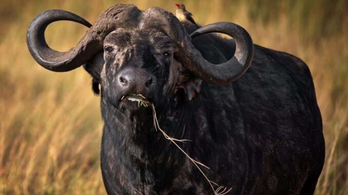
The destructive impact of these large animals on the environment is well-documented. Standing at 188 cm tall and weighing up to 1,200 kg, feral buffalos consume substantial amounts of grass and vegetation, damage rock art, trample ceremonial sites, and disrupt culturally significant waterways. This not only poses a threat to the delicate ecosystem but also undermines the economic stability of Northern Australia.
In response to this challenge, scientists, in collaboration with local stockmen and Indigenous rangers, have launched a four-year program to monitor the movement and behavior of these animals using advanced technology.
The SpaceCows initiative, supported by the Australian government’s Smart Farming Partnership, utilizes solar-powered GPS tags attached to the animals by rangers and stockmen.
The GPS tag data are then transmitted directly to a space-based satellite system orbiting at an altitude of 650 km, where they can be accessed and analyzed for up to two years. The Commonwealth Scientific and Industrial Research Organisation (CSIRO), the government agency spearheading the program, has leveraged Microsoft technologies to create a digital platform for SpaceCows, incorporating AI algorithms and cloud services from Azure.
This provides a more robust solution for tracking and managing the animals in the challenging terrains of Australia’s far north. The technology enables the creation of a digital twin of the land, incorporating terrain and weather data to enhance the accuracy of the tracking system.
Andrew Hoskins, a senior research scientist at CSIRO, emphasizes the significance of the project, stating, “This (is a) really large-scale tracking project, probably of the largest scale from a wildlife or a buffalo tracking perspective that’s ever been done.”
The data collected will not only help monitor the movement patterns of these animals but will also contribute to a better understanding of the baseline disease status among the buffalo population.
The information gathered through SpaceCows will empower rangers and conservationists to focus their efforts. By identifying areas where the animals concentrate, measures such as fencing off crucial sites or selective murder can be implemented.
This article by Trinity Sparke was first published by One Green Planet on 4 January 2024. Image Credit: Wirestock Creators/Shutterstock.
What you can do
Help to save wildlife by donating as little as $1 – It only takes a minute.
[ad_2]
Source link

Leave a Reply